Departure from Cima Passo Giau, take summer path no. 436 in the direction of Forcella Giau, continue along no. 436 to Forcella Ambrezzola, then towards Forcella Col Duro. Then continue on path no. 467 towards Forcella de Col Roàn, continue on 467 towards the Città di Fiume Refuge.
Take path no. 472 towards Passo Staulanza, then descend for 500 m along the asphalted road; at the first hairpin bend, take road 568 towards Casera Fontanafredda. From here, you access the downhill slopes and descend towards Alleghe.
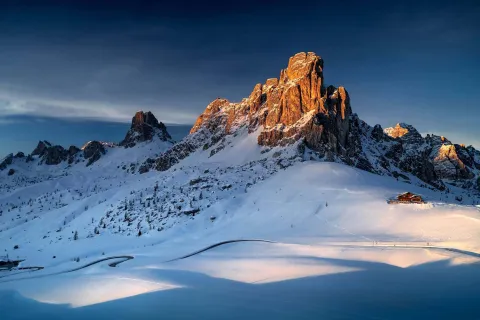
Full of panoramic views, the landscape is very wild and coarse, with typical dolomitic features. The route crosses the most important Dolomite massifs: Cernera, Croda da Lago, Monte Pelmo, Col Duro, Lastoi de Formin, Monte Coldai.
- DOLOMITE GROUP Cernera, Croda da Lago, Lastoi di Formin
- SLOPE variable (mostly south facing)
- DIFFERENCE IN ALTITUDE Clockwise: +300 m; anticlockwise: +700 m
- DEPARTURE From Passo Giau path no. 436
- ARRIVAL Alleghe
- RECOMMENDED TIME better early in the morning
Source: dolomiti.org
Option of using the summer trail map for easier orientation.
Materials: Ski touring equipment, shovel, probe, avalanche transceiver
Variants: Option of travelling the same route in an anticlockwise direction