Along the Pedemontana Veneta
Under the Venetian Prealps, castles, towers and curtain walls tell a story of contested borders, rival lordships and competing powers vying for control of the plain. One of the great fortress-towns, the Pedemontana Veneta has some of the best-preserved medieval defensive systems in the region, now transformed into places to explore with walkways, fortresses and striking panoramas.
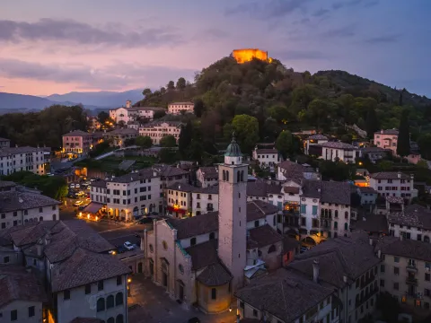
The Rocca, which has dominated Asolo’s hilly landscape for centuries, was enlarged several times over the years and constituted the principal defensive stronghold of this strategic territory. Together with the Castle that hosted the court of Catherine Cornaro, the Rocca tells the story of the fortified past of one of the most charming towns in the Veneto. Open to visitors today, it boasts a panorama that stretches from the Asolo Hills to the Lagoon on the clearest days.
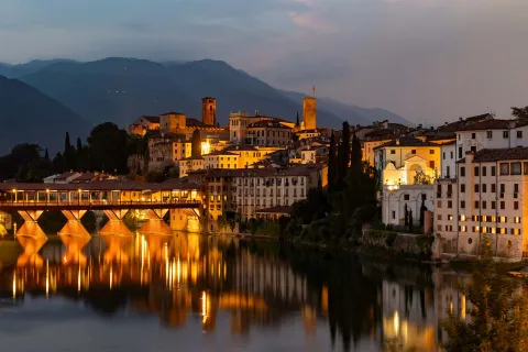
Overlooking the Brenta and protected for centuries by walls, towers and fortified gates, Bassano del Grappa preserves important evidence of its medieval past. The Ezzelini Castle, heart of the city's defensive system, is one of the main landmarks of the historic centre and recalls the strategic role the town played in controlling the routes between the plain and the alpine valleys. Of the ancient fortifications, stretches of the walls, a few towers and the historic gates that still provide access to the city remain.
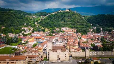
Marostica is famed for its extraordinary fortified system consisting of two castles connected by a striking curtain wall that climbs the hill above the town. Built by the Scaligers, the defensive complex includes the Lower Castle, which faces onto Piazza degli Scacchi, the Upper Castle and almost two kilometres of walls that design the town's profile. This heritage provides the backdrop to the famous Living Chess Match, which every two years transforms the historic centre into a large open-air stage.
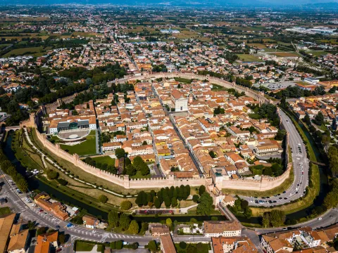
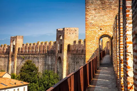
Founded in 1220 by the Municipality of Padua as a military garrison at the border of its territory, Cittadella is home to one of the best-preserved medieval curtain walls, the only elliptical-shaped wall completely walkable in Europe. The imposing defensive system, about 1,500 metres long and interspersed with towers and battlements, still encloses the historic centre today. The complete wall-walk is open to the public, offering a privileged vantage point over the town and the surrounding landscape.
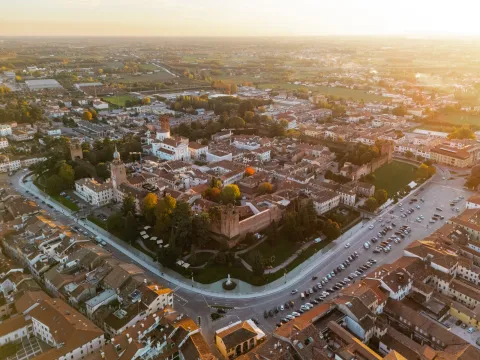
Massive brick walls, corner towers and a wide moat still enclose the heart of Castelfranco Veneto, one of the best-preserved walled towns in the Veneto. Built as a strategic stronghold on the Venetian plain, the town retains an almost perfectly preserved defensive layout that still defines its urban aspect. Inside the walls is the Cathedral which houses the famous Pala di Castelfranco masterpiece by Giorgione.
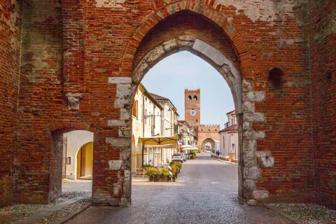
At the heart of the dominions owned by the Tempesta family, Noale still preserves a fortified layout that recalls its past as a strategic centre between Padua, Treviso and Venice. The historic centre is still characterised by the Rocca dei Tempesta, the Clock Tower and the Bell Tower, monuments that allow visitors to retrace the past of one of the most important lordships of the Venetian mainland before the expansion of the Serenissima.
The fortresses of Garda
Stretching along the Venetian banks of Lake Garda is a continuous sequence of defensive systems that speak to centuries of strategic control and protection of the local area. Scaliger castles, curtain walls and Venetian fortifications design a landscape in which water becomes a defensive element and military architecture is an integral feature of the local towns.
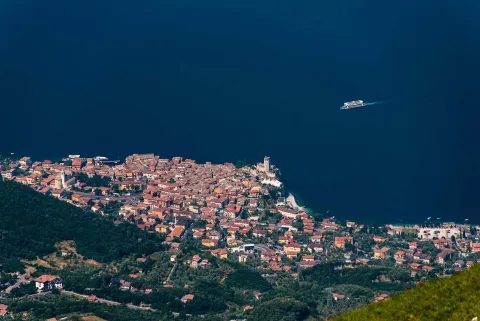
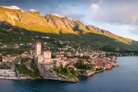
Perched on a rocky spur overlooking Lake Garda, the Scaliger Castle of Malcesine is one of the best-preserved medieval fortifications in the Veneto. Its crenellated walls, fortified courtyards and imposing keep tell of centuries of conflict and domination. Today the castle is open to visitors and houses the Natural History Museum of Monte Baldo and Garda and the Goethe Room, which contains images of the lake and the Castle that the poet sketched during his stay.
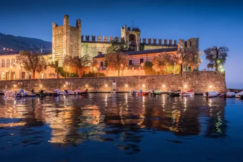
Torri del Benaco owes its name to the "torri" - or towers - that for centuries kept watch over one of the most strategic stretches of Lake Garda. Dominated by the Scaliger Castle and directly facing the waters of Garda, the village still conserves traces of the ancient walls and of the defensive layout developed between the Middle Ages and the Scaliger period. Today it is home to an ethnographic museum and preserves a historic eighteenth-century lemon house, one of the few that can still be visited on the lake.
The origins of Bardolino's fortifications date back to the ninth century thanks to King Berengar. The defensive system was later expanded by the Scaligers, who transformed the town into a single walled enclosure. Although many of the structures have been lost, the medieval layout can still be seen in the urban fabric and in the remains of the fortifications: Porta San Giovanni to the north and Porta Verona to the south, a few stretches of the wall and a defensive tower on the waterfront.
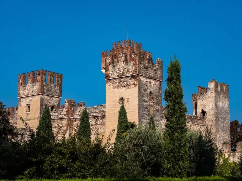
The walls that completely surround the historic centre make Lazise one of the most complete examples of a fortified town on Lake Garda. Built during the Scaliger period, it includes the castle, crenellated walls, towers and the three gates that still provide access to the town; the defensive complex was completed by the military harbour and the arsenal, later converted into the Dogana Veneta, which today hosts events and cultural activities.

Contested by the Scaligers and the Visconti, Peschiera del Garda took on its present form under the rule of the Serenissima, which transformed it into one of the most advanced strongholds of its defensive system. To this day, the bastions, curtain walls and monumental gates create a unique urban layout that is perfectly integrated with the water. Since 2017 the complex has been inscribed on the UNESCO World Heritage List as part of the transnational site Works of Defence of the Venetian Republic between the 16th and 17th centuries: Stato da Terra – Stato da Mar Occidentale.
The very name Castelnuovo del Garda - 'New Castle of Garda' - recalls its fortified origins: in fact, a medieval castle once stood on the summit of the hill overlooking the historic centre. The current Torre Viscontea, sole surviving element of the fortress and symbol of the town, bears witness to the important defensive role the town played when, after defeating the Scaligers, Gian Galeazzo Visconti built a new castle protected by a double ring of walls.
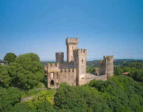
The Scaliger Castle and the Visconti Bridge are the symbols of the fortified system that for centuries protected Valeggio sul Mincio. From the castle walls, which look over the town from the top of the hill, to the imposing dam-bridge commissioned by Gian Galeazzo Visconti, the town preserves evidence of a complex apparatus that defended one of the main crossing points of the Mincio.
Today these places can also be discovered by bike, following the Mincio River cycle path which, starting from Peschiera del Garda, passes through the nearby town of Borghetto and goes all the way to Mantua.